
Sea Stacks «Devil's Finger» and «Devil's Gates» — East Sakhalin 4×4 Excursion
Sakhalin's Pacific-facing eastern shore is not on any tourist map — it has no harbour, no road signs and no café. What it has is a 60-kilometre stretch of uninterrupted wild coastline where two basalt sea stacks, Devil's Finger and Devil's Gates, rise from the surf with a force that earns both names. AMIST's east-coast 4×4 day runs to the bluff above the stacks, down to the pebble beach, and back — with a Pacific shore picnic and enough time for every lens in the group.
About the excursion
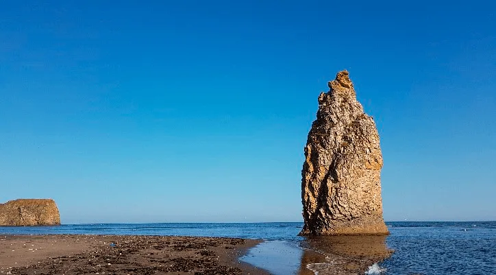
Devil's Finger (Chyortov Palets) and Devil's Gates (Chyortovy Vorota) are the two most dramatic sea stacks on Sakhalin's eastern Pacific shore — a roughly vertical 40-metre basalt column and a twin-pillar arch through which Pacific swells pour at every tide. AMIST has been routing private 4×4 groups to this stretch of coast since the early 2000s, and the track remains genuinely rough and genuinely worthwhile.
The drive east
We collect guests from their Yuzhno-Sakhalinsk hotel in the early morning. The route east crosses the island's central watershed and drops to the Pacific coastal plain through the Poronaisk district — roughly 190 km via the M-6 highway, about 3.5 hours with one fuel stop. The coastal horizon appears long before the stacks: a long flat line where the Sea of Okhotsk and the sky meet with almost no visual interruption. After the highway the final 8 km is an unpaved forest track that becomes firm and reliable in dry conditions and deeply rutted in wet; we select departure days accordingly, or switch to our all-season 4×4 fleet when recent rain makes the gravel uncertain.
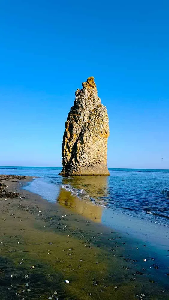
The track ends on a bluff about 30 metres above the beach. Devil's Finger is immediately visible — a near-vertical column rising from the surf to the south, its dark basalt face cross-hatched by the vertical jointing left when the lava cooled. Beside it the twin pillars of Devil's Gates frame a seagate that the guide explains is still being widened by wave undercutting from below, measurably further from the cliff face than it was a generation ago.
Down to the beach
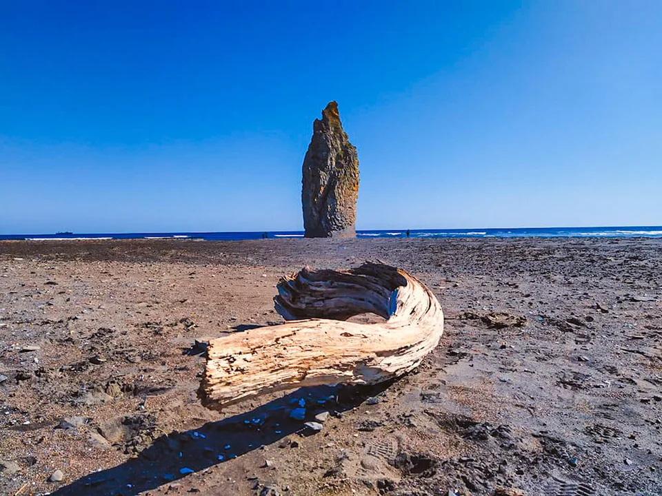
A short descent by a boot-worn path brings the group to the pebble beach below — dark volcanic shingle interspersed with rounded basalt boulders, each wave arriving obliquely from the south-east in long, white-edged lines. From beach level the scale of Devil's Finger becomes legible: the column is roughly eight storeys tall, and the surf at its base never fully settles. On calm days the swell still pulses visibly through the Gate, trailing white foam across the dark stones. On windy days the spray reaches the bluff.
We spend 1.5 to 2 hours between the bluff and the beach: the guide covers the tectonic context (Eurasian-Pacific plate boundary, Cretaceous basalt, wave erosion timescales), identifies the seabird colonies nesting on the upper ledges — Slaty-backed Gull, Black-tailed Gull — and points out the harbour seals on the lower boulders in late summer. Photography is the central activity: our guides know which angle on the bluff frames both stacks without the other hiding behind it, and which tide phase fills the Gate most completely.
Pacific shore picnic
After the stacks we move a few kilometres south along the coast to a sheltered cove for a packed lunch on the pebble shore: fresh sandwiches, hard-boiled eggs, smoked fish, fruit, tea from a thermos. There is no facility, no table, no bin — we carry everything in and carry everything out. The Pacific horizon extends unbroken to the east; on clear days there is nothing between the lunch spot and the coast of Hokkaido but open water.
What makes it AMIST
The east Sakhalin coast is unglamorous to drive and spectacular to arrive at. Most visitors never reach it because the track requires genuine off-road capability and a driver who has done it before. AMIST's east-coast runs have been operating since the early 2000s; our team knows which creek crossings flood after rain, where the track narrows to single-vehicle width, and which sections of bluff are stable enough for extended standing. We keep groups to four to six guests so the beach below Devil's Finger is left exactly as found.
Practical notes
- Season: Late June – September for reliable road access. Autumn storms produce spectacular skies but make the bluff trail treacherous after rain.
- Duration: ~10–11 hours door-to-door; hotel pickup 7:00–7:30 am, return approximately 6–7 pm.
- Distance: ~190 km each way via M-6 highway; final 8 km unpaved track.
- Vehicles: High-clearance 4×4 throughout. Standard cars and minibuses cannot complete the final track section.
- Group size: 4–6 guests maximum.
- Included: Hotel pickup, all 4×4 transfers, guide throughout, picnic lunch on the Pacific shore.
- Not included: Personal accident insurance (available through AMIST).
- To bring: Non-slip footwear for the pebble descent, windproof layer, polarising filter for cutting sea-glare, 200–400 mm telephoto for the stacks and seabirds, fully charged camera batteries.
- Often combined with: Cape Velikan (巨人角) for a full Pacific coast day; confirm availability with AMIST.
Gallery
Upcoming departures
Choose a convenient date and book your spot
Pricing
Season: Island Kunashir, year-round
| Тариф | Pricing |
|---|---|
| Excursion by запросуPrice рассчитывается под даты and состав группы | On request |