
Cape Slepikovsky & Kholmsk — Southwest Sakhalin Lighthouse & Port Town
Southwest Sakhalin's coastline drops sharply to the Tatar Strait, and Cape Slepikovsky — registered in the AMIST glossary as one of the island's named headlands — marks the point where the strait narrows toward the mainland. This full-day tour pairs the cape's working lighthouse with a walking tour of Kholmsk, Sakhalin's second city and the terminus of the legendary ferry link to Vanino on the mainland. Two very different faces of island life, joined by a single spectacular coastal road.
About the excursion
A day along Sakhalin's most dramatic edge: the southwest coast where basalt cliffs fall to the Tatar Strait, a working lighthouse that guards one of Russia's busiest sea lanes, and the layered port city of Kholmsk — all connected by a coastal highway that qualifies as a destination in itself.
What you'll do
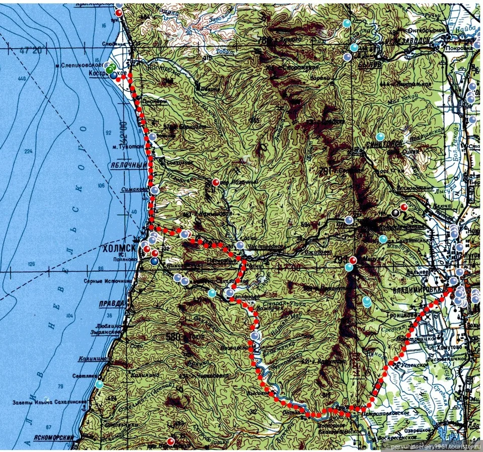
We depart Yuzhno-Sakhalinsk at 8:30 am and drive south-west on the Trans-Sakhalin Highway toward Kholmsk. The road climbs the Susunai Range, drops to the coastal plain, and then clings to the cliffs above the Tatar Strait for the final forty kilometres — a stretch where the mainland Russian coast is visible on clear days, roughly 40 km to the west across the narrowest point of the strait. This is the same water crossed by escaped prisoners in the 19th century and by Soviet freight ferries daily until the late 20th century.
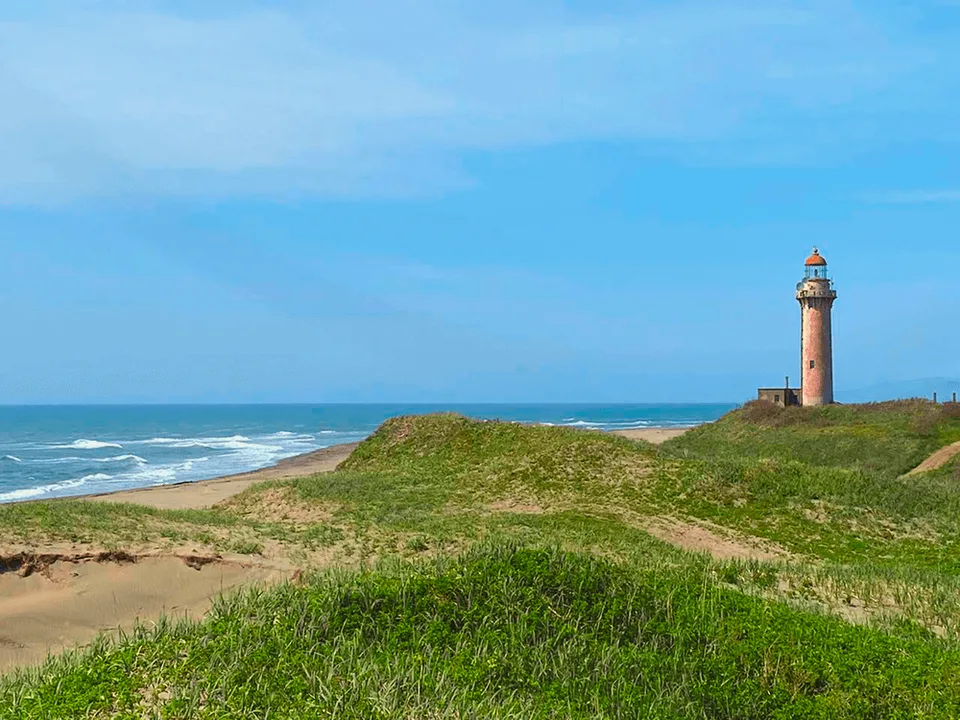
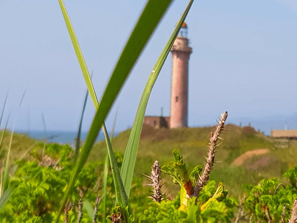
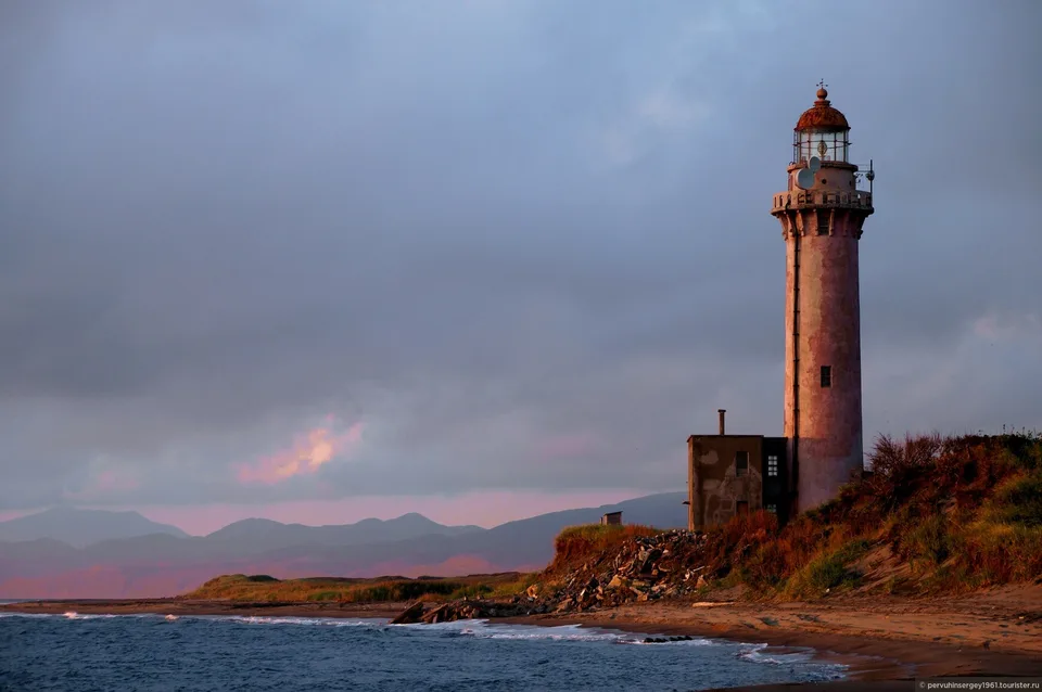
The first stop is Cape Slepikovsky (Mys Slepikovskogo), named for Mikhail Slepikovsky, a Russian surveyor active in the late 19th-century Sakhalin surveys. The lighthouse here is operational — a white concrete tower maintaining the navigational light for Tatar Strait shipping — and sits on a headland that gives unobstructed views north and south along the cliff coast. We allow 45–60 minutes here: the viewpoint above the lighthouse, the trail along the clifftop to the next promontory, and the sea watching below where common murres and horned puffins nest in the basalt crevices between May and August.
From the cape we continue twenty minutes south into Kholmsk (Kholmsk, population ≈ 26 000), Sakhalin's second city and the terminus of the Vanino–Kholmsk ferry. During the Japanese Karafuto period (1905–1945), the city was known as Maoka (真岡) and served as a significant administrative and industrial centre. Substantial Karafuto-era buildings survive in the lower town — the former post office (now repurposed), the Maoka railway station building (the Kholmsk narrow-gauge railway ran until 1994), and the characteristic low-roofed worker housing on the hillside streets. Our walking tour of the port district lasts about 90 minutes, visiting the ferry terminal overlook, the memorial to the Battle of Maoka (August 1945), and the Orthodox church repurposed from a Karafuto-era building. Lunch is at a local port-district café — fresh halibut or crab from the Kholmsk fish market depending on the day's catch, with black bread and local beer.
We return to Yuzhno-Sakhalinsk via a slightly different inland route, stopping at the Susunai Range viewpoint for the eastward panorama over the Central Sakhalin Lowland. Return by 7 pm.
What makes it AMIST
The Cape Slepikovsky–Kholmsk pairing is deliberate: the lighthouse represents Sakhalin's present geography (an active maritime safety installation on one of Russia's key sea lanes) and Kholmsk represents its layered past — Russian, Japanese, Soviet, and post-Soviet simultaneously. Our guide is fluent in the Karafuto history and will distinguish myth from documented record at each site. We also know Kholmsk's fish market schedule and arrive when the morning catches are in — the difference between generic café food and a proper halibut lunch is a two-hour timing decision.
Practical notes
- Duration: ~10.5 hours door-to-door, pickup 8:30 am, return ~7 pm.
- Distance: ~180 km each way (Yuzhno-Sakhalinsk ↔ Kholmsk), including Cape Slepikovsky detour.
- Included: hotel pickup and return, transport, guide, café lunch (halibut or crab set menu).
- To bring: windproof jacket (clifftop winds are strong year-round), comfortable walking shoes, binoculars for seabirds, wide-angle lens for coastal panoramas.
- Season: Year-round. Seabirds at the cape May–August. Snow on the Susunai crossing November–April adds drama but requires winter tyres (our vehicle is equipped).
- Physical: ~3.5 km total walking on mixed surfaces. One clifftop section requires care in wet weather.
The Tatar Strait in context
The Tatar Strait (Tatarskiy Proliv) separates Sakhalin Island from the Russian mainland over a minimum width of about 40 km at the Kholmsk latitude. The strait was named by the French explorer Jean-François de Galaup, comte de Lapérouse, who charted its southern end in 1787 and incorrectly concluded that Sakhalin was a peninsula. Gennady Nevelskoy corrected the record in 1849, proving the strait's full extent. The ferry link between Kholmsk and Vanino (Khabarovsk Krai) was the island's primary connection to the mainland until the air route expanded in the 1980s; the ferry still runs as a cargo-passenger service, and watching a vessel enter or leave the harbour from the cape is one of the authentic pleasures of this coast.
Gallery
Upcoming departures
Choose a convenient date and book your spot
Pricing
Season: 01.05 — 15.11.2026
| Тариф | Pricing |
|---|---|
| СборныйГрупповая by графику | 9 000 ₽ |
| Родные and близкиеИндивидуально для 2–4 близких | 10 000 ₽ |
| СемейныйИндивидуально для семьи | 12 000 ₽ |
| VIPПерсональное сопровождение | 16 500 ₽ |