Sakhalin
1 photo
Buruny Bay (Southeast Sakhalin)
An open-ocean Pacific beach 8 km from Tikhaya — sea caves, sea stacks and waterfalls visible only at low tide
Description
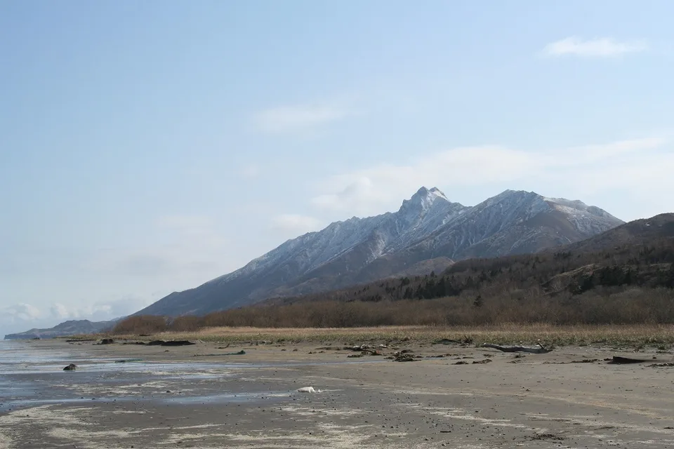
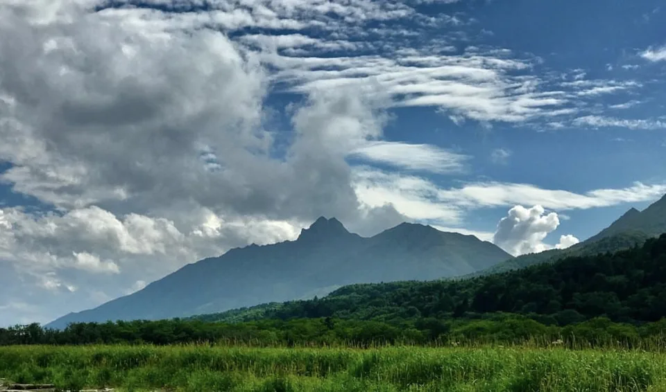
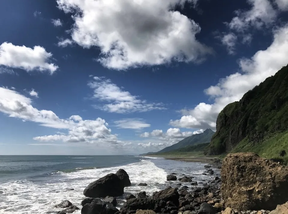
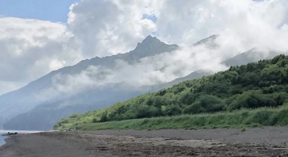
The name is itself an instruction. Buruny — the Russian word for surf, for the white-crested waves that peel across a shallow sandbar and exhaust themselves on the shore. Buruny Bay is one of southeast Sakhalin's most elemental beaches: a long crescent of dark volcanic sand open to the full fetch of the Sea of Okhotsk, with the Zhdanko Ridge on the horizon and water that never settles, summer or autumn.
Where it is and how it formed
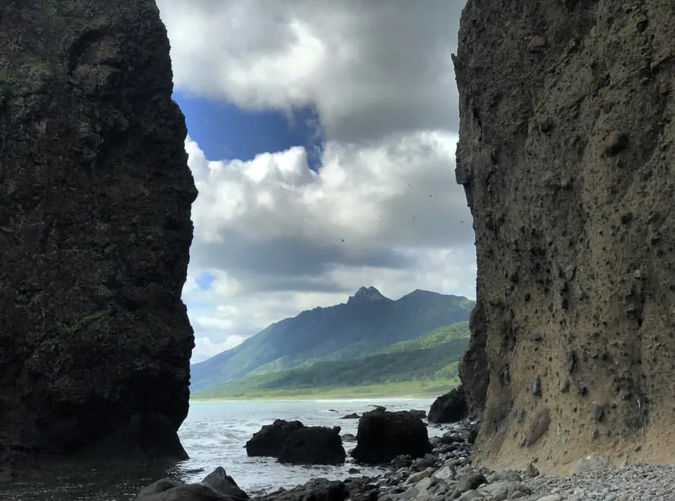
Buruny lies roughly 8 km north of Tikhaya Bay, occupying a broad embayment in the southeast Sakhalin coastline between Aniva Bay and Terpeniya Peninsula. The coast faces the open Sea of Okhotsk, which generates persistent north-easterly swell during the autumn storm season and long-period rollers through summer. The beach material is characteristically Sakhalin in its darkness — grey-black sand derived from the erosion of the island's andesitic and basaltic volcanic rocks, interspersed with rounded cobbles of the same material where the beach narrows at its headland ends.
The shallow offshore gradient means swell refraction begins well offshore and waves arrive at the beach as organised breaking lines rather than the chaotic shore-dump of steep beaches. It is this aesthetic, almost orderly surf that gives the bay its name — and that draws the few Sakhalin surfers who have the will to cross the ridge for it. Behind the beach, a low ridge of marram-stabilised foredune separates the sand from a hinterland of mixed birch, larch and pine forest.
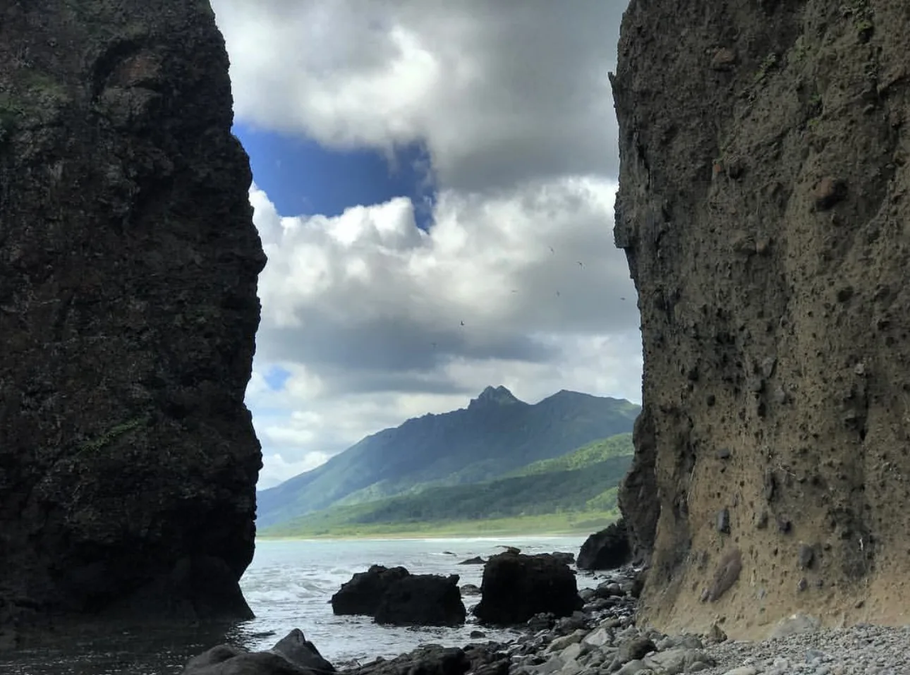
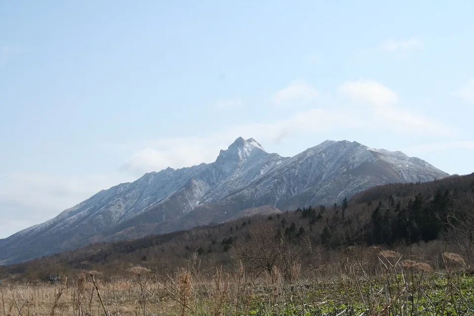
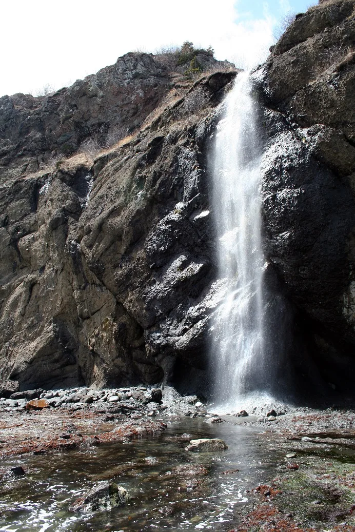
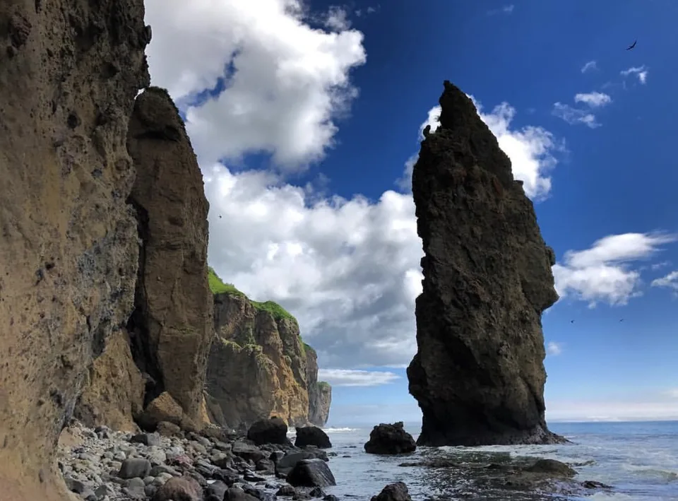
Between surf line and the foot of the hills, much can be found only in the tidal window: sea caves, oddly shaped sea stacks (kekury), cliffs and waterfalls that «appear» when the water draws back. One look at Zhdanko Ridge is enough to stop hurrying.
Approach
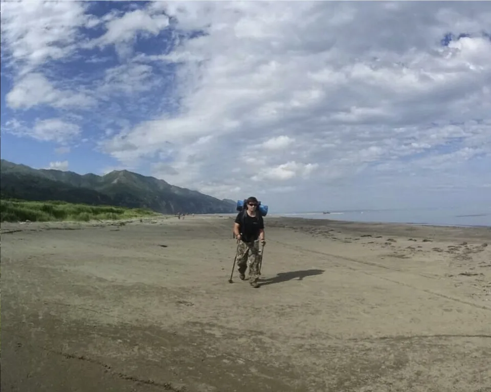
There is no road to the bay. You either cross the pass near Mt Bogatyr on foot — two to three hours each way for someone who knows the trail — or come by sea from Tikhaya. Mountain streams with drinkable water make a pack-in water supply unnecessary; an AMIST guide who knows the line saves time and worry.
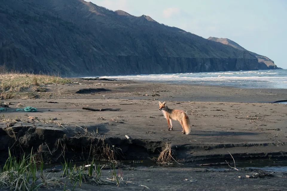
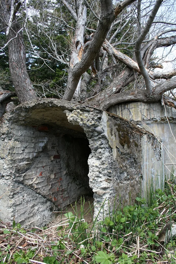
The descent is partly overgrown with Kuril bamboo: the old path that once led easily to the shore now demands attention. After an hour or two of walking you emerge on a long sand beach where a settlement once stood. Today the bay is empty — wind, sand and the sound of water.
Practical information
- Access: Independently, over the Mt Bogatyr pass — two to three hours each way for those familiar with the route; or by sea from Tikhaya. AMIST programmes Buruny into southeast-coast jeep itineraries.
- Season: June through early October. July–August holds the steadiest weather; September–October brings the most dramatic surf and the most rain.
- Time on site: 1.5–2 hours on the beach; a full day including the approach.
- Swimming: Not advised. Even at moderate swell the surf remains powerful, and there are no lifeguards.
- Bring: A windproof shell (the beach is almost always windy), UV and polarising filters for the strong side-light off the Okhotsk Sea, hiking or rubber boots for the damp dune crossing; full waterproofs in September–October.
Why we keep this stop
Buruny is the opposite of a tourist beach. On a fine summer weekday you can walk twenty minutes along the surf without seeing another person — rare for a beach of this surf quality. AMIST pairs it with Tikhaya and the Zhdanko Ridge not as a sightseeing item but as a quiet day by the water, no programme. You come here to watch the Pacific work — not to enter it.
Gallery

1 / 12
On the map
Want to see Бухту Буруны?
We will arrange an excursion to this and other attractions