
Sakhalin
1 photo
A stone railway viaduct in the hills above Kholmsk — Japanese 1920s engineering, abandoned in 1945
A stone railway viaduct in the hills above Kholmsk — Japanese 1920s engineering, abandoned in 1945
Description
Buried in the steep forested hills above Kholmsk on Sakhalin's western coast, Devil's Bridge is the most evocative piece of Japanese-era engineering still standing on the island — a multi-arch stone railway viaduct abandoned mid-sentence when the Soviet Union took control of southern Sakhalin in 1945.
A railway that crossed a mountain
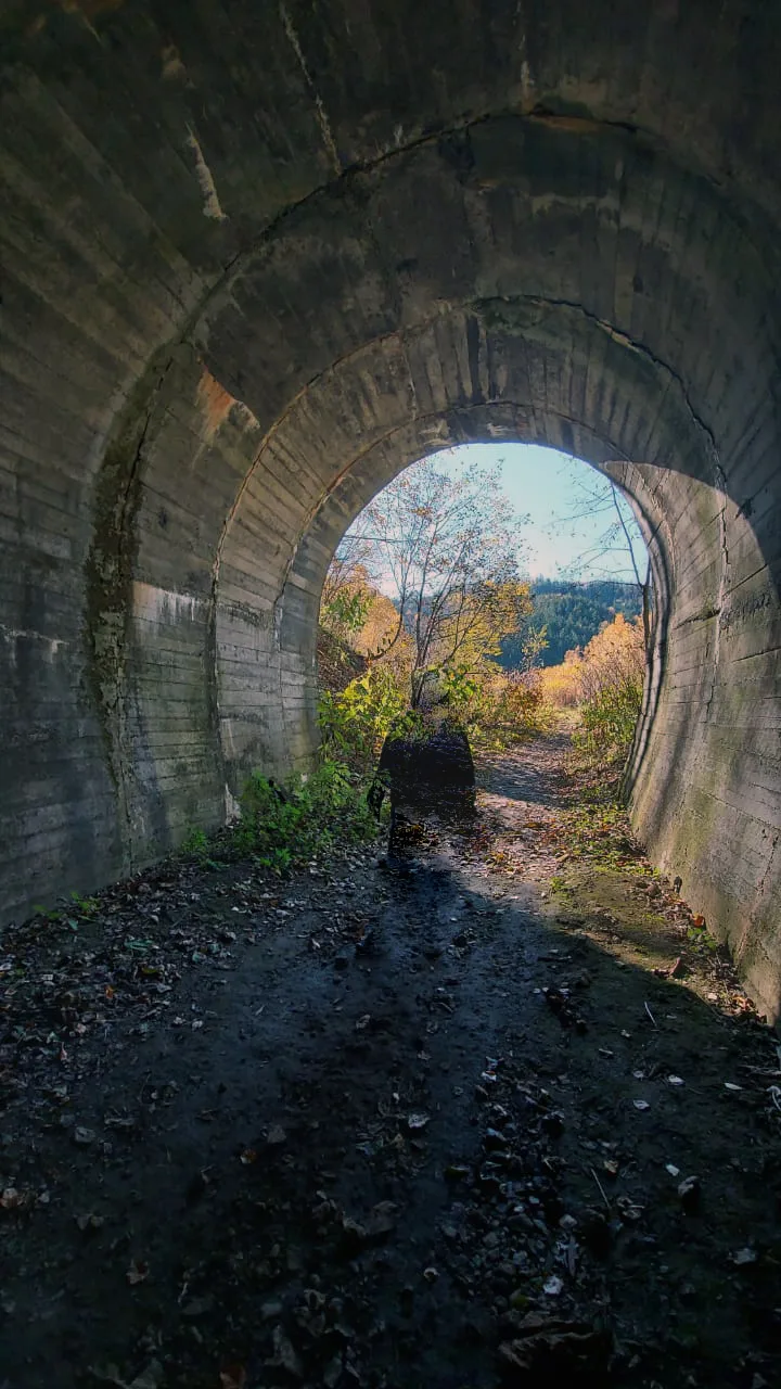
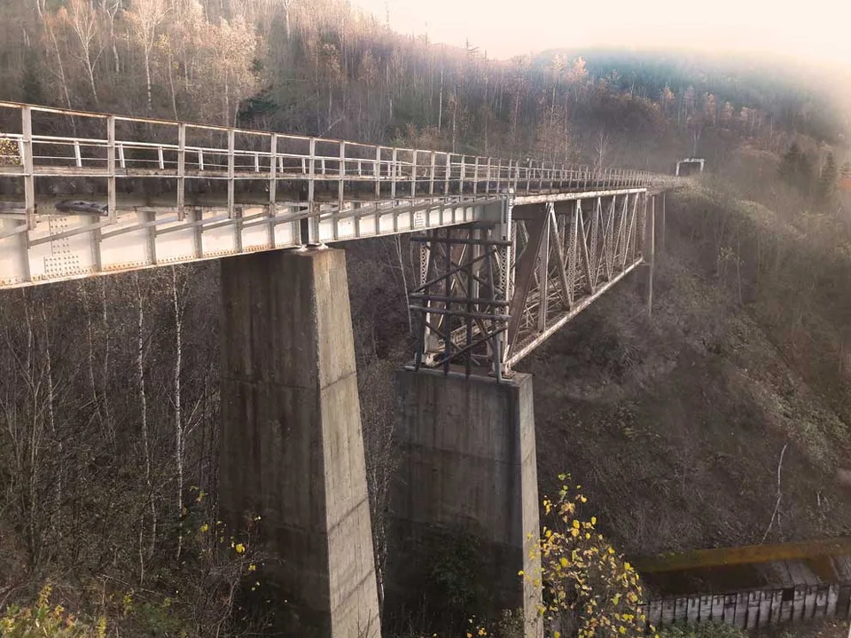
During the Karafuto Prefecture period (1905–1945), Japan built an impressive narrow-gauge railway network across southern Sakhalin, including a demanding mountain crossing designed to link the western port of Maoka (now Kholmsk) with the central and eastern parts of the island. The line — known in Japanese as the Hoshinsen — climbed through switchbacks and engineered structures: tunnels, cuttings and several viaducts, carved into slopes that would challenge a modern road-builder. Construction ran from 1921 to 1928; in those seven years 35 bridges and 15 tunnels were laid down, the longest tunnel running 870 metres. Today only the Nikolaichuk station, 12 km from Kholmsk, remains operational; everything else is tunnels and bridges.
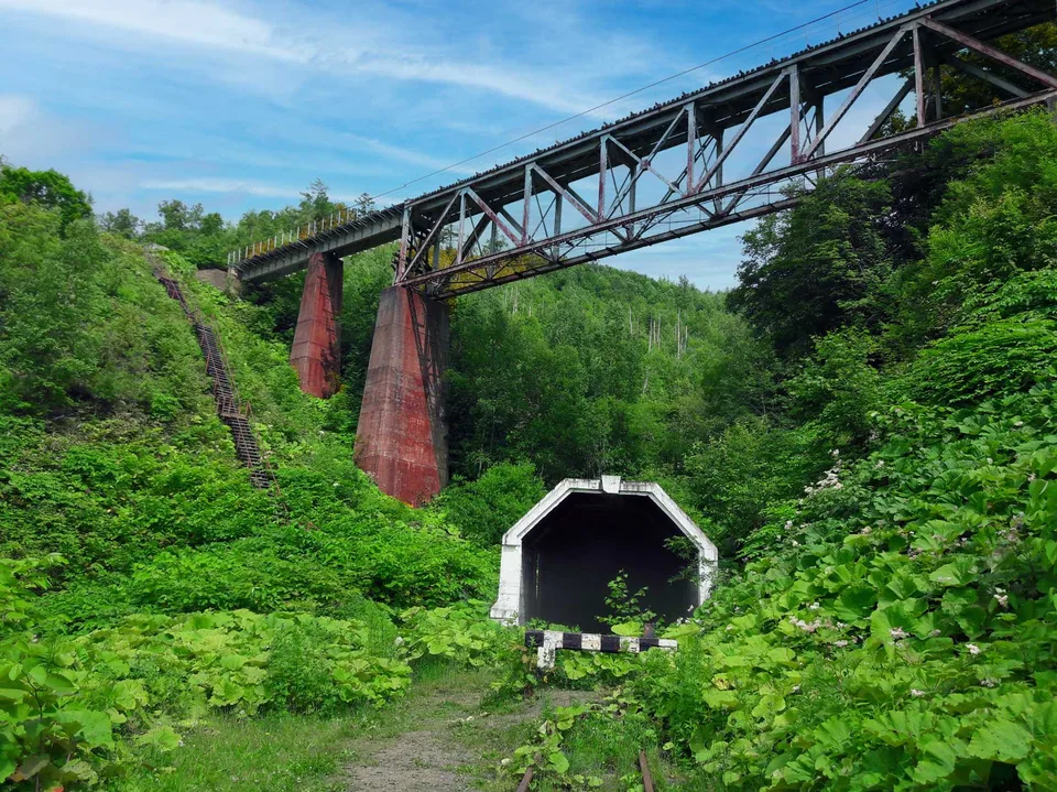
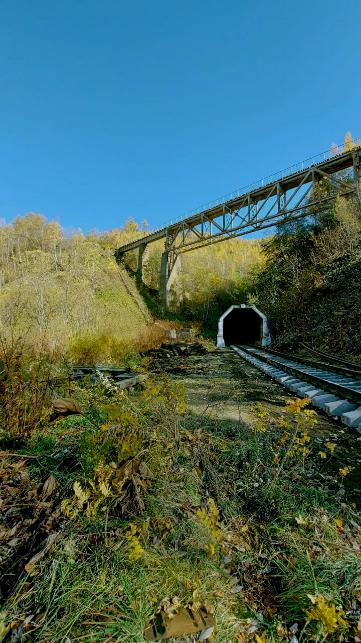
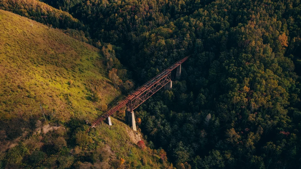
Devil's Bridge (Chyortov Most) is the largest surviving viaduct on this line, and not a single span but a small complex of three tunnels and two bridges. A train would shoot out of one tunnel, fly across the gorge on the lattice of the bridge, immediately enter another tunnel, then another bridge, then a spiral tunnel from which it emerged at the same point on the plan but nearly fifty metres lower down. Seen from outside, time in the hill seemed to bend: the locomotive came out of the tunnel while the last carriage was still directly above it.
By one local legend, this geometry was proposed by an engineer named Chertov, working with the Russian crew on the construction: an error was found in the original survey, the gentle descent could no longer be built, and the line had to be wound into a spiral. The engineer's name fastened itself to the devil's loop forever.
What you see today
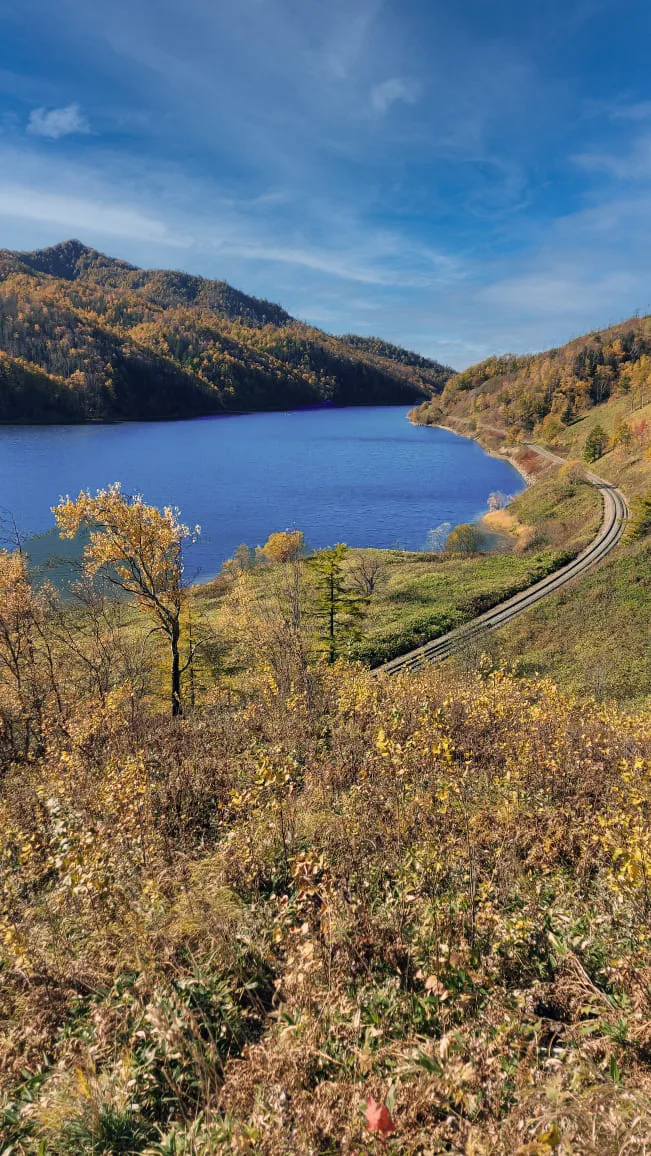
The structure has been almost dramatically reclaimed by Sakhalin's vegetation. The stone arches still stand solidly — testament to Karafuto-era craftsmanship, executed without modern machinery — but every horizontal surface is mossed, ferned and birched, the summer understorey almost tropical in density. In the gorge below the bridge, the stream still runs heavy with snowmelt into early July.
The viaduct lies 1–2 km on foot from where the road ends (depending on seasonal conditions), through forest where the old railbed remains visible. Fragments of sleepers and rusted spikes line the path right up to the bridge. On the deck the scale becomes plain: from the centre of the span, the forested gorge falls 15–20 metres to the streambed.
Practical information
- Location: Kholmsk district, western Sakhalin; about 90 km from Yuzhno-Sakhalinsk via the trans-island road.
- Drive: The final stretch needs 4×4. Seasonal closures during spring breakup and after heavy snow.
- Walk to bridge: 1–2 km one way, moderate ground; waterproof boots required.
- Season: May–June for snowmelt drama and low vegetation; July–August for green canopies and full sun; September–October for autumn colour against the stonework.
- Bring: Waterproof boots, insect repellent (June–August), a wide-angle lens for the stone-and-time framing, and unhurried time — the late-afternoon shafts through the canopy onto the arches are worth it.
- Safety: The deck is technically walkable but has not been professionally surveyed. The AMIST guide holds the group at a safe distance; the main vantage points are at the tunnel mouth and from the gorge below.
What we make of this stop
Devil's Bridge is not a "sight" with a ticket booth and a signpost. Reaching it takes local knowledge, a capable jeep and a small leap of imagination, and that is precisely why it produces an impression no curated heritage site can match: a piece of civilisation paused mid-step, then quietly metabolised by the taiga. AMIST pairs it with Kholmsk port itself and other Karafuto-era remnants for one- and two-day routes along Sakhalin's western coast. We have been working this stretch since the early 2000s — we know seasonal closures, trail conditions and the angle from which the stone spiral reads best.
Gallery
1 / 6
On the map
Want to see Чёртов bridge?
We will arrange an excursion to this and other attractions