Sakhalin
1 photo
Mount Klokova
An 865-metre peak above Patience Bay — stone-pine ascent and east-coast Sakhalin panorama
Description
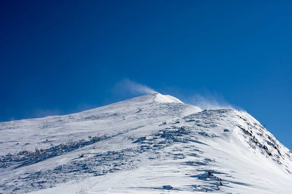
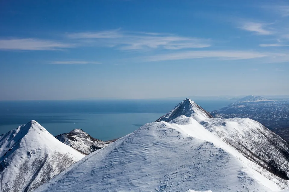
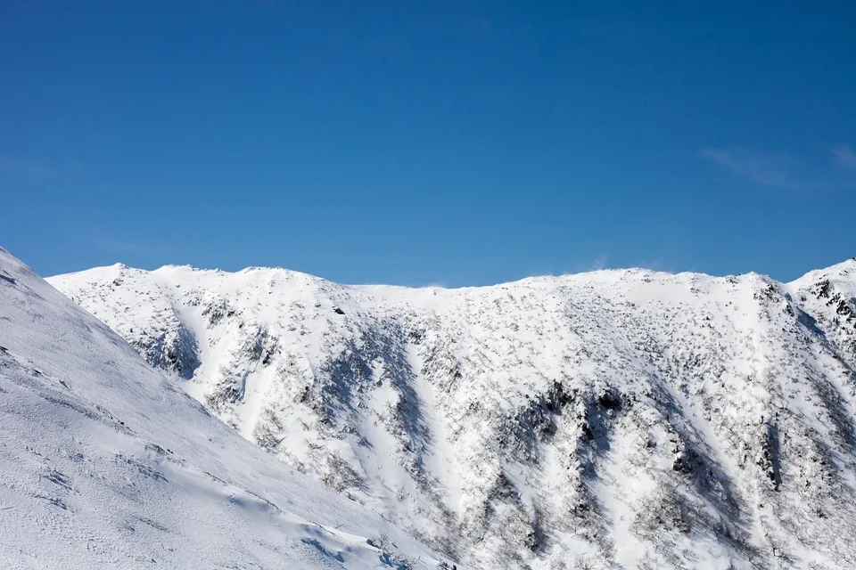
Mount Klokova, at roughly 865 metres, is one of the most distinctive summits in Sakhalin's Makarov district. Together with Mt Oktyabrskaya (533 m) and Mt Michurin (732 m), it forms a coastal massif on the western shore of Patience Bay (Zaliv Terpeniya), running from the railway stations of Grebenskaya to Zaozyornaya and standing apart from any other ridge system. Seen from the coast — for example from the town of Makarov — Klokova dominates the cluster.
The name behind the mountain
The peak gives its name to a cape that runs straight into the sea and to a waterfall about 300 m off the highway: see Klokovsky Waterfall. The toponym is most often linked to V. S. Klokov, head of the South Sakhalin Railway in the 1950s and 1960s — the massif sits very close to the line, which makes the attribution plausible, though direct documentation is thin.
An ascent, not a stroll
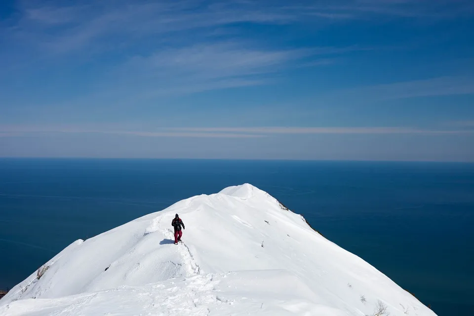
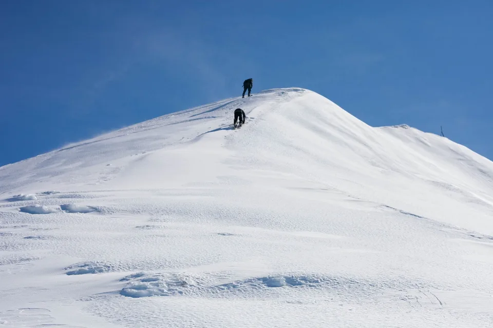
The summit promises long views and a horizon hidden from the road, but reaching it is not a stroll. The dwarf pine — Pinus pumila — is the main adversary in summer: branches sprawl downhill in knotted mats, feet sink into root tangles, long needles scratch, and the springy boughs rebound at the slightest pressure. You think you have a line through the thicket, take another step, and find yourself shoulder-deep in green.
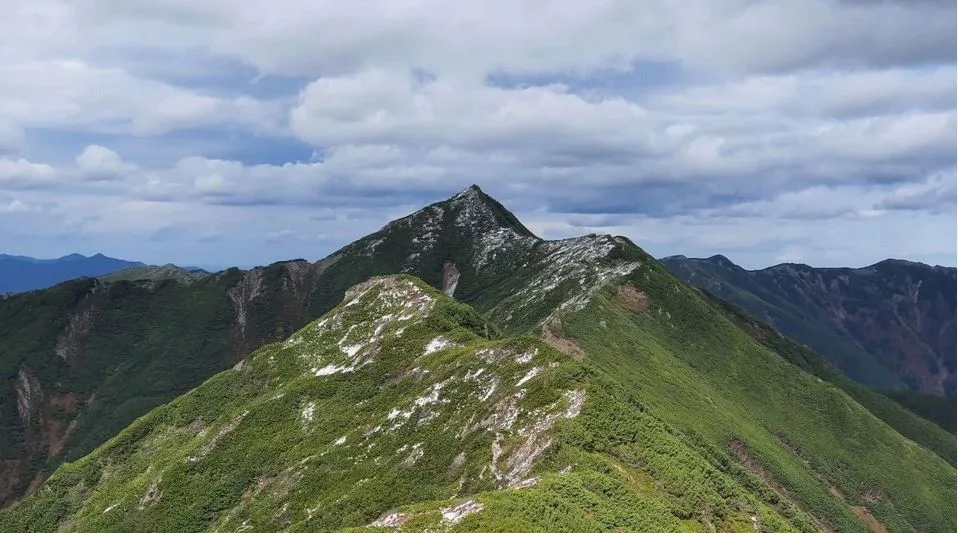
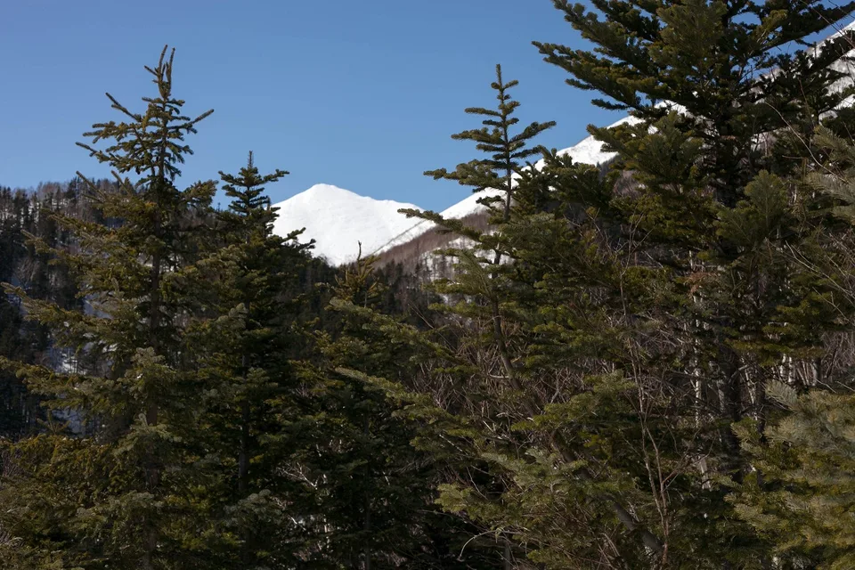
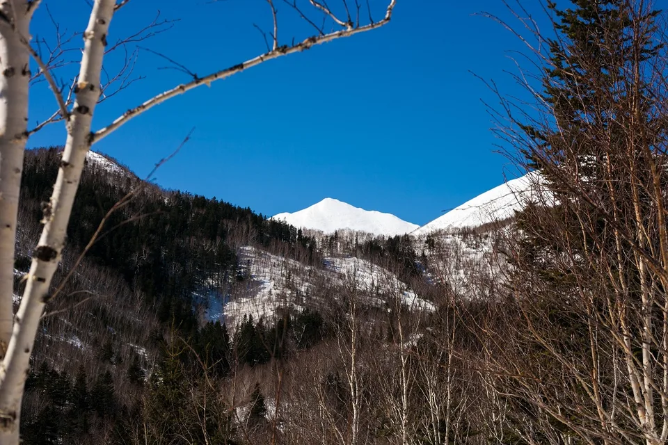
Lower slopes pass through mixed Sakhalin forest, predominantly Sakhalin fir (Abies sachalinensis) and Erman's birch. Higher up the treeline gives way to the dwarf-pine-and-Kuril-bamboo zone, and finally to open rocky terrain on the upper ridge. The summit block involves hands-on scrambling on stable but locally loose quartzite and shale.
What the view shows
On a clear day the Sea of Okhotsk lays itself out in layered blues to the horizon; the Kuril silhouette is sometimes legible to the south-east, and the relief-map of Sakhalin's interior unfolds to the west in alternating ridges and valleys. There is no better high vantage on the east coast that can be reached without a helicopter.
Flora and fauna
The altitude gradient compresses a varied succession of habitats into one walk. Lower forests hold Sakhalin red deer and brown bear, both most active at dawn and dusk. The subalpine zone carries characteristic Sakhalin highland flora in July–August: Sakhalin goldenrod, several dwarf rhododendrons, and tall fireweed (Chamaenerion angustifolium) flooding open ground in fuchsia. Rock ptarmigan hold the summit cliffs year-round; old golden-eagle nests sit on the eastern wall.
Practical information
- Summit: Approximately 865 m (sources vary; geodetic data place the adjacent block in a 1,280–1,320 m range for parts of the massif).
- Difficulty: Demanding. Suited to fit hikers with scrambling experience; no technical equipment required in summer conditions.
- Season: Mid-July through mid-September. Snow lingers in shaded gullies until late June; first snowfalls reach the upper ridge in early October.
- Trailhead: The east-coast highway, 2.5–3 hours from Yuzhno-Sakhalinsk. AMIST provides transfer and a certified mountain guide.
- Bring: Boots with ankle support, trekking poles, a windproof shell (weather above 900 m changes fast), sun protection for the open ridge, bear spray (carried by the guide).
- Water: Mountain streams are reliable on the lower approach; above the treeline you carry your own.
Who this peak is for
Eastern Sakhalin's upland is one of the least-visited trekking regions in the Russian Far East. The reason isn't a lack of scenery; it's that working safely here demands route knowledge, current permits, and bear-country protocol. AMIST has run small-group trekking on the Zhdanko system for more than a decade; the accumulated route experience and safety record are what turn Klokova into a realistic objective for fit international visitors.
Gallery


1 / 9
On the map
Want to see Гору Клокова?
We will arrange an excursion to this and other attractions