
Sakhalin
8 photos
Golovnin Caldera
The southernmost active caldera of the Kurils — Boiling Lake at pH 2.2 and broad Hot Lake in one crater
Description
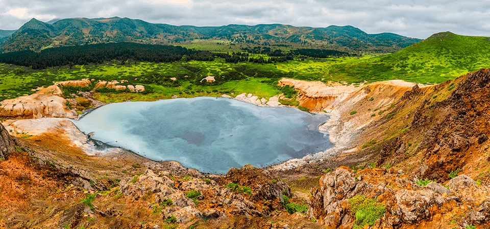
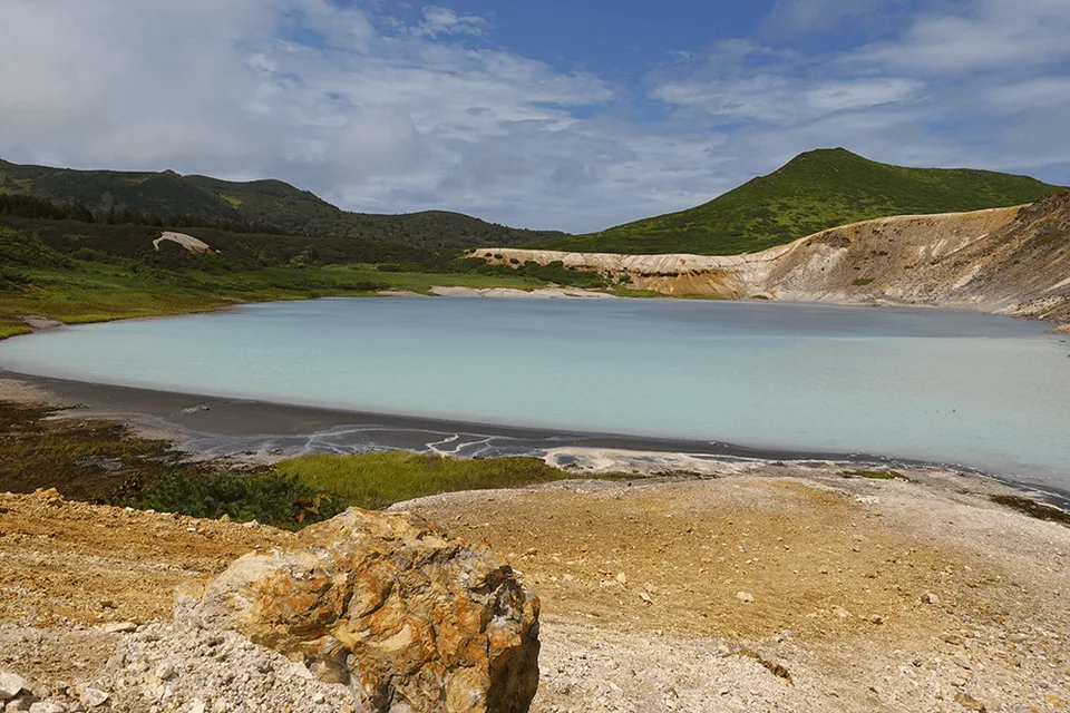
A four-kilometre bowl collapsed into the south of Kunashir, cradling two lakes — one acid-blue and hissing with fumaroles, the other broad and mineral-warm. Golovnin is the southernmost active caldera of Russia, and the place we send travellers when they ask what the Kuril Chain really feels like.
A volcano that ate itself
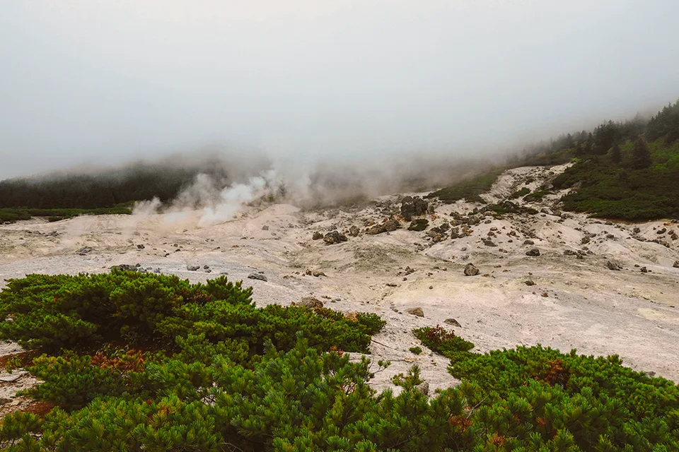
Golovnin is an andesite-dacite stratovolcano whose summit collapsed roughly 40,000 years ago in a catastrophic caldera-forming eruption. What remains is a ring of forested ridges — high point 541 metres — enclosing a crater five kilometres across. The floor is far from quiet: four post-caldera lava domes pushed up through the basin, a strong hydrothermal eruption was recorded around 600 years before present, and the ground still breathes steam along the southern shore. Golovnin sits inside the Kurilsky State Nature Reserve, a strict protected area where access is by permit only.
The two lakes
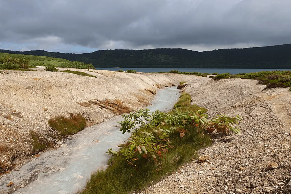
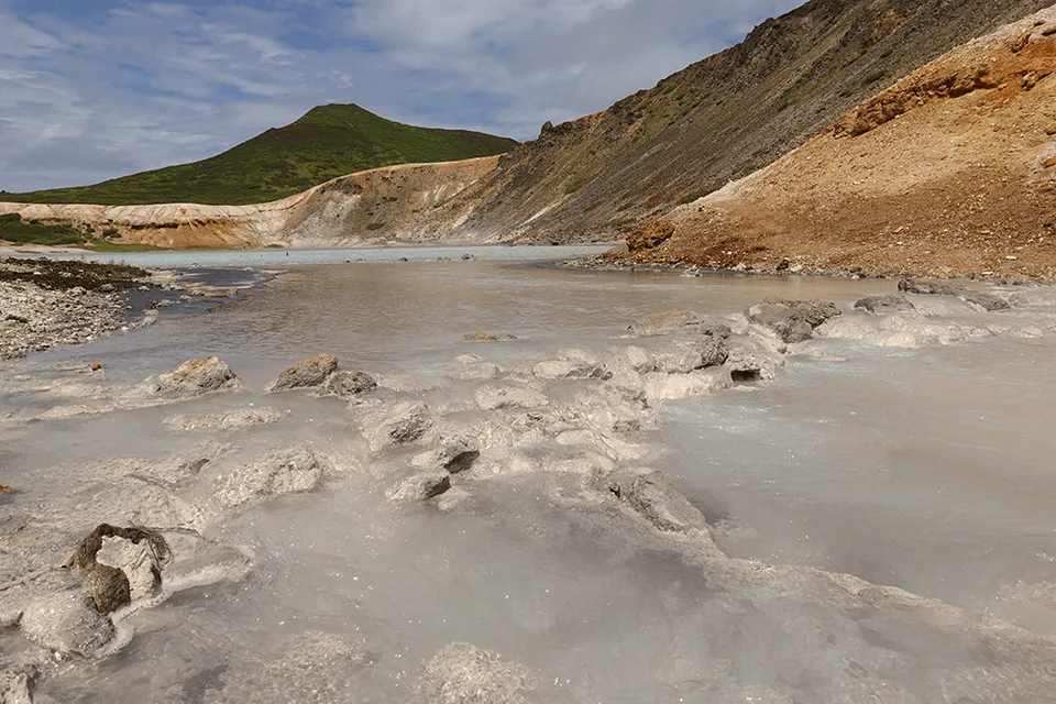
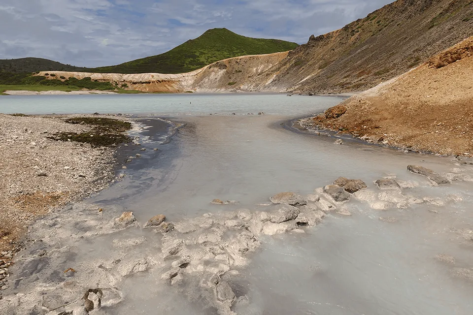
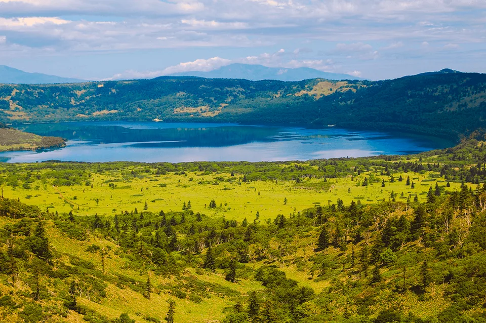
Kipyashee — Boiling Lake is the smaller and stranger of the pair: 4.5 hectares, 17 metres deep, ultra-acid at pH 2.2, the colour of poured milk shot through with cobalt. Hydrothermal vents fire steam columns straight out of the shoreline, and a cluster of sulfurous mud pots hisses beside the path. The water temperature along the active zone can climb from 30°C to near boiling. Goryachee — Hot Lake is 290 hectares of broad, mineral-warm water draining quietly northward to the Sea of Okhotsk via the Ozernaya River. A 400-metre creek named Sernyi (Sulfur) connects the two. In late summer the Ozernaya fills with spawning chum salmon — and with the bears that follow them.
The walk in
From Yuzhno-Kurilsk a 4WD transfer of around 40 minutes brings you to the forest barrier of the reserve. From there the trail climbs gently through what looks like ordinary taiga — until you notice that the understorey is solid chest-high Kuril bamboo (Sasa kurilensis), and the trail is the only narrow gap through it. In early summer the forest edge carries the pink of rare Sakhalin rhododendron. Seven kilometres one way, an unhurried 2.5–3 hours; the strongest moment is the rim arrival, when the ground tips and the caldera unrolls beneath your feet.
Practical information
- Season: July through mid-September. Outside this window the rim is under snow and the reserve closes the route.
- Permits: Kurilsky Reserve permit is mandatory; AMIST applies seven working days in advance — passport details required at booking.
- Ranger escort: Each group walks with a reserve inspector. Brown bear activity along the Ozernaya in August–September is a real factor, not marketing.
- Bring: Broken-in waterproof boots, rain shell, layered clothing, 1.5 litres of water, insect repellent.
- Group: Capped at eight, so that the caldera remains the loudest thing present.
The best day on Kunashir
Kunashir is the most active stretch of the Kuril Chain — four active volcanoes on one island, less than 25 km from Hokkaido, almost no tourist infrastructure. AMIST has run small-group programmes on Sakhalin and the Kurils since 2001, with direct relationships into the reserve and leaders who are local to Yuzhno-Kurilsk. Golovnin is the best day we can give to a guest who wants to feel geology through their feet.
Gallery

1 / 8
On the map
Want to see Кальдеру вулкана Головнина?
We will arrange an excursion to this and other attractions