Island Kunashir
1 photo
Sea Stacks «Devil's Finger» and «Devil's Gates»
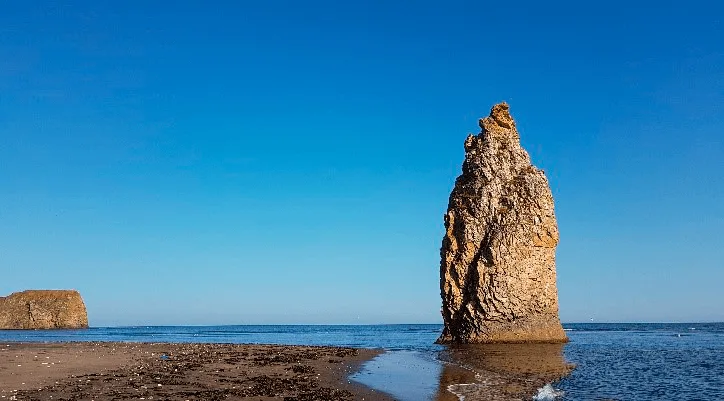
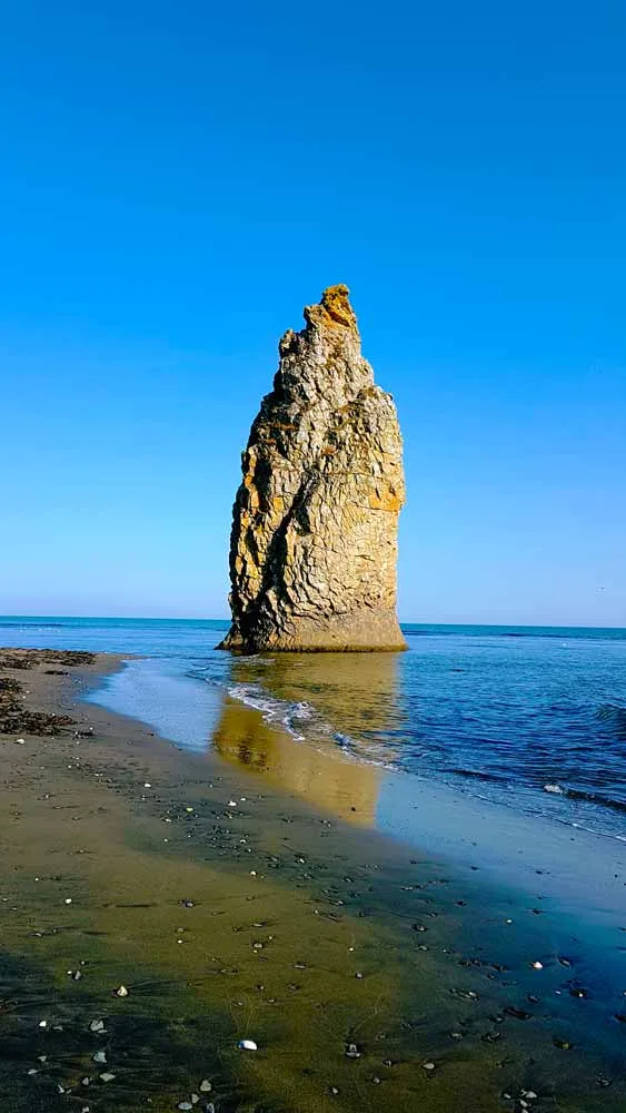
A 40-m basalt needle and a twin-pillared sea gate on Sakhalin's east coast — the island's most theatrical sea stacks
Description
Two volcanic needles punching skyward from the surf-churned eastern shore of Sakhalin — Devil's Finger and Devil's Gates are the most theatrical sea stacks on an island already known for dramatic coastlines. On Kunashir the same family name covers a small ensemble: the first Devil's Finger is locally called «Monk» for the clearly readable face and monastic cap (the skufya), the Devil's Gates stand just south of Cape Sukachev, and a second Devil's Finger closes the group.
Geology written in basalt
The kekury — the Russian term for sea stacks isolated from a headland by wave erosion — along the Sakhalin Pacific coast are products of tectonic collision. The island sits on the boundary of the Eurasian and Pacific plates, and the rocks here are a compressed mosaic of Cretaceous basalt, tuff and marine sediment. The cylindrical Devil's Finger (Chyortov Palets) rises roughly 40 metres from sea level as a nearly vertical column, its surface cross-hatched by joints left when the lava cooled. Beside it — and connected to the mainland cliff by a narrow basalt arch at low tide — stand the twin pillars of Chyortovy Vorota, the «Devil's Gates»: two flanking stacks framing an open seagate that surging Pacific swells pour through with particular force during onshore storms.
Wave undercutting continues to widen the arch and deepen the channel between the Gates; geologists estimate the formation has retreated several metres from the cliff face over the last century. On calm days the swell still surges visibly through the gap, trailing white foam across the dark pebble beach.
The coast in context
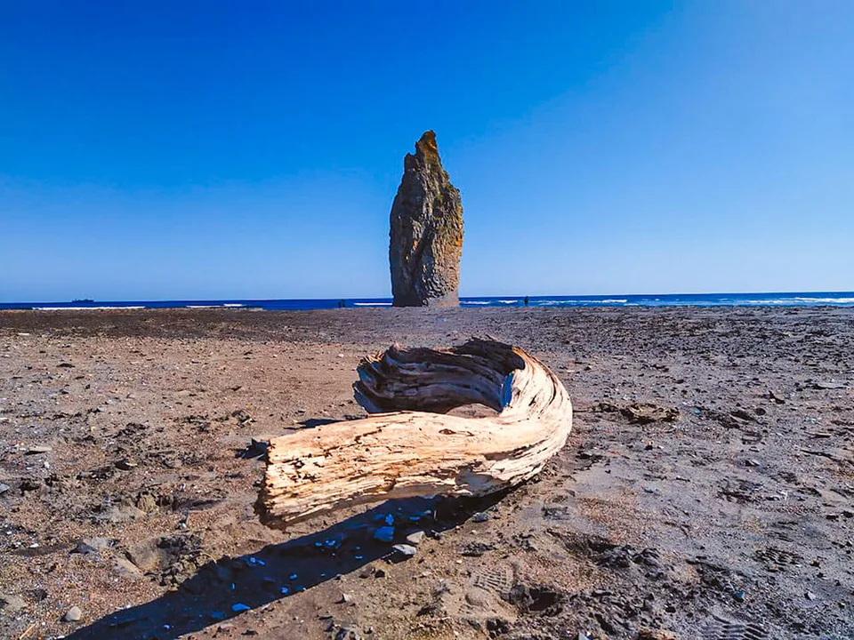
The stacks stand on the eastern, Sea-of-Okhotsk-facing shore, roughly between the towns of Starodubskoye and Gastello in the Poronaisk district — a stretch of coast that has no sea-wall and no tourist infrastructure, only a gravel track that ends above the bluff. The beach below is dark volcanic pebble interspersed with rounded basalt boulders, the surf perpetually breaking in long white lines that roll obliquely from the south-east. On clear days the Pacific horizon extends unbroken for over a hundred kilometres; on overcast days sea and sky blur into a single slate plane that throws the silhouette of the columns into sharper relief.
Seabird colonies — slaty-backed gull, black-tailed gull and occasional pelagic cormorant — nest on the inaccessible ledges of the headlands; harbour seals haul out on the lower reefs at low water in late summer.
Photography and time of day
The stacks face roughly east: the first dawn light at about 05:30 in midsummer hits the basalt frontally and turns it deep amber before the sky neutralises. Mid-afternoon side-light brings out the vertical jointing in bas-relief. Storm views from the bluff are powerful, but a safe approach requires a guide who knows the cliff path — it can be treacherously slippery after rain. A 200–400 mm tele works here: you can catch the moment a swell passes through the Gates without going close to the water.
Practical information
- Location: Eastern Sakhalin, Poronaisk district. About 190 km and 3.5 hours from Yuzhno-Sakhalinsk via the M-6 highway.
- Season: Late June through September for the most reliable road and weather; autumn storms give the most dramatic skies but make the cliff path slippery.
- Access: The final 8 km is unpaved forest track; 4×4 required — the standard configuration for AMIST east-coast tours.
- Time on site: 1.5–2 hours on the cliff and beach; usually paired with Cape Velikan or a Pacific-coast picnic.
- Bring: Boots with grippy soles (the pebbles are slippery), windproof, polariser for shooting.
The east coast as it is
Sakhalin's east coast is the island's undeveloped face — no fishing port, no fuel station, no signposted trail. The Devil's Finger sits in the middle of a sixty-kilometre stretch of wild coastline, and most visitors don't make it for an obvious reason: the road is genuinely poor and the return is long. AMIST has been running private east-coast 4×4 trips since the early 2000s; we know which creek floods after rain, the angle from which the Gates read in full and where to park so the seals don't leave their reef. Groups capped at four to six, so the beach below the Finger stays as you found it.
Gallery

1 / 6
On the map
Want to see Кекуры Чёртов палец and Чёртовы ворота?
We will arrange an excursion to this and other attractions