
Island Iturup
3 photos
Yankito Lava Plateau
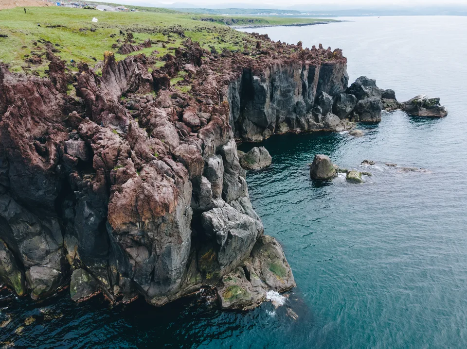
A black-basalt shoreline on northern Iturup — lava flows that froze in the Pacific
Description
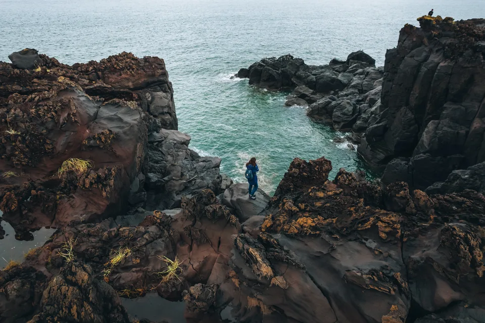
A shoreline that looks as if the sea had tried to pour itself into iron. Yankito is Iturup's black-basalt edge — a lava plateau fused into the Pacific, chiselled into fins and spires by wind, swell and 45,000 salt-heavy winters. Of all the places we take guests on Iturup, this is the one that rearranges their idea of a coastline within thirty seconds.
How the rock got there
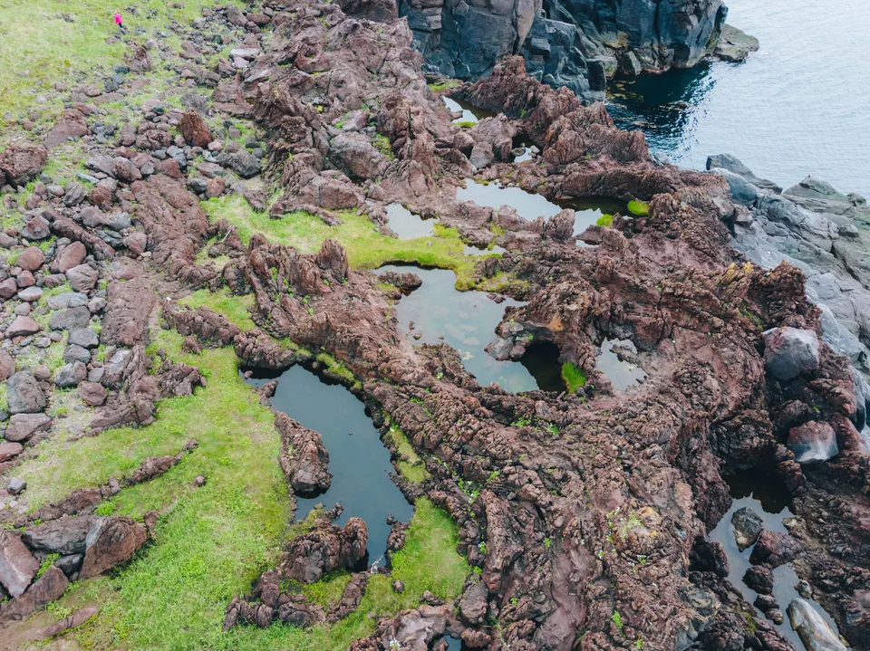
Northern Iturup is a seam of active volcanoes — Bogatyr Ridge to the south, Baransky further inland, and a cluster of late-Quaternary flows that unrolled across the coast and froze on contact with the ocean. The result is a plateau of basaltic-andesitic lava — stacked columnar joints, collapsed tubes, obsidian-dark cliffs — reaching perhaps twenty metres above the tideline and continuing out through the surf as a field of stacks and reefs. Wind off the Pacific has been sculpting the upper surface for tens of millennia; salt spray does the finishing work. The locals call the tallest spires "fingers". They look exactly like that.
By local tradition, the plateau owes itself to Bogdan Khmelnitsky volcano: a few thousand years ago the coastal cone erupted often, sending hot-flowing magma into the ocean, filling the irregular ground and freezing on the move. The pointed rocks in their fantastical shapes were left behind.
What you see on the ground
A short walk from the access road brings you out onto a flat rampart of dark rock. Sand beaches lie in the coves between lava tongues — black sand, iron-heavy, the waves sorting magnetite into dark streaks across the surface. Tide pools sit in hexagonal column-tops. Kuril rhododendron and dwarf pine cling to the landward edge, flowering pink-purple in June and early July. In clear weather the volcanic cones of Bogatyr Ridge fill the southern horizon, and on the cleanest days you can make out Chirpoy and Urup stacked to the north. There are no barriers, no boardwalks, no concessions. Footing is uneven; the rock eats hiking boots.
Practical information
- Location: Roughly 45 km from Kurilsk, Iturup's administrative town. Access is by 4WD over unpaved volcanic road.
- Best season: June through September. Earlier the track is mud; later, storms come in.
- Time on site: 2–3 hours, walking between lava terraces and black-sand pocket coves at an unhurried pace.
- Bring: Boots with ankle support, windproof, polarised sunglasses (the dark rock is glare-bright in sun), a wide-angle lens. Water and a hot lunch travel with AMIST — there is no shore-side service.
- Iturup access: Iturup is a restricted border area; AMIST submits permits 30 working days in advance, passport details at booking.
The anchor of an Iturup day
Iturup is not a place you visit on the side: flights are sparse, weather variable, permits non-trivial. Yankito is the anchor of our day route there — the landscape that explains why the northern Kurils are some of the least photographed and most distinctive coastlines in Russia. AMIST has been running small-group programmes through the Kurils since 2001; on Iturup we work with Kurilsk-based guides who know which cove opens at which tide and which winds to avoid.
Gallery
1 / 3
On the map
Want to see Yankito Lava Plateau?
We will arrange an excursion to this and other attractions