
Sakhalin
5 photos
Cape End of the World
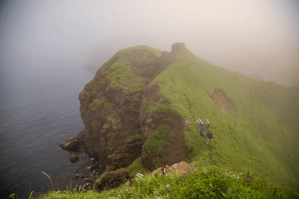
The eastern cliff-edge of the Kuril Chain on Shikotan — 40 metres of basalt over the open Pacific
Description
The name is not theatre. Cape End of the World (Mys Kray Sveta) is the eastern cliff-edge of Shikotan, where the Kuril Chain drops into the Pacific and the next solid land in that direction is North America. From the top of the cliff the open ocean stretches to the horizon, and the phrase "edge of the world" stops being a metaphor.
The geography of absolute edges
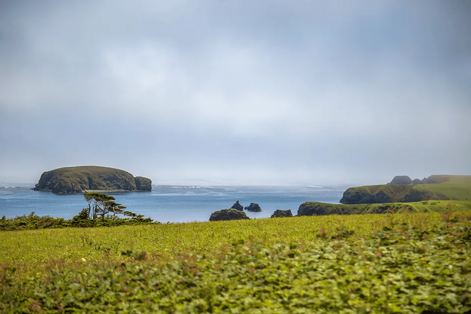
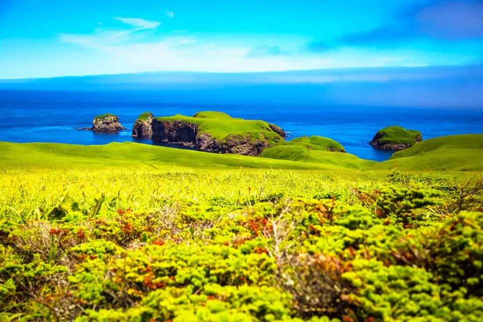
Shikotan is the second-largest island in the Lesser Kuril Chain, roughly 27 kilometres long, basalt-cored and wrapped in scrub oak, bamboo grass and wind-bent alder. Its eastern coast is a nearly unbroken escarpment of dark volcanic cliffs rising 30 to 40 metres from the sea. At the headland that has come to carry the name Cape End of the World, those cliffs meet a gap in the coast where the ocean swells arrive unimpeded from several thousand kilometres of open Pacific fetch. The result — and this is one of those cases where a landscape is simply described, not embellished — is waves of extraordinary scale crashing against a wall of black rock under an unobstructed sky.
The headland sits on the island's northeastern flank. On clear days the arc of the open ocean is visible from horizon to horizon, with no other land in sight. Shikotan is part of the Lesser Kuril Islands (Malaya Kurilskaya Gryada) and of Sakhalin Region in the Russian Federation.
The approach
Reaching Cape End of the World requires an inter-island transfer by boat or light aircraft from Sakhalin or Kunashir to Malokurilskoye, the main settlement on Shikotan. From the village a rough coastal track — partly driveable by 4WD, partly on foot — leads northeast along the cliff tops. The final section is a short walk across open grassland to the cliff edge itself.
Standing at the rim of these cliffs is a different category of experience from a viewpoint with a hand-rail. There is nothing decorative here: no barriers, no café, no information panels. Just the wind, the vertical drop, the unbroken plane of the sea, and a sharp clarity about where you are physically standing on the planet. When the swell is up and the wind cooperates, spray reaches the top; the sound of the surf is loud and continuous.
July and August are the most reliable weather window. Fog is an established Kuril feature and can come in at any time; our guides build flex into every Shikotan itinerary.
Practical information
- Permit: Shikotan is a border-controlled zone; an FSB border-zone pass is required for all visitors. AMIST handles permit applications — allow 30–45 days; carry passport throughout.
- Travel: Flight Yuzhno-Sakhalinsk to Kunashir (Mendeleyevo airport), then boat transfer to Shikotan; or, when available, direct charter. AMIST consolidates the full logistics.
- Season: Late June through mid-September. Outside the window, Pacific swell makes the boat crossing impractical.
- On site: Walk on grass-top trails, easy to moderate. The cliff edge is unfenced — solid footwear and attention needed.
- Bring: Full windproof and waterproof outer layer (spray does reach the top), polarised sunglasses, a wide-angle lens for the seascape and a tele lens for cliff-face seabird colonies.
What this cape offers
Most travellers in the Russian Far East come for volcanoes, sea stacks or Soviet ruins. Cape End of the World offers something rarer: a place where the world physically ends. The logistics are real — permits, inter-island transfers, weather dependence — and that is precisely why almost no one is standing where you will be standing. AMIST has run Kuril programmes for more than twenty years; on Shikotan we treat the island as a destination in itself, not an extension of Kunashir, and Cape End of the World remains the anchor of any single-day route on the island.
Gallery

1 / 5
On the map
Want to see Cape End of the World?
We will arrange an excursion to this and other attractions