Sakhalin
1 photo
Cape Sima (Symau)
The Ainu "dwelling of stones" on Sakhalin's east coast — figures in the rocks, a clear river, and a bear-fishing waterfall upstream
Description
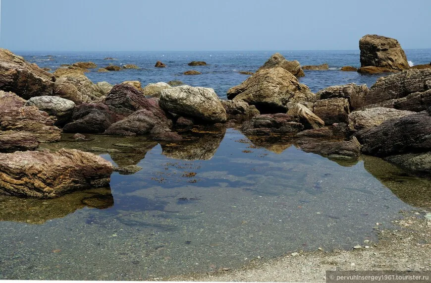
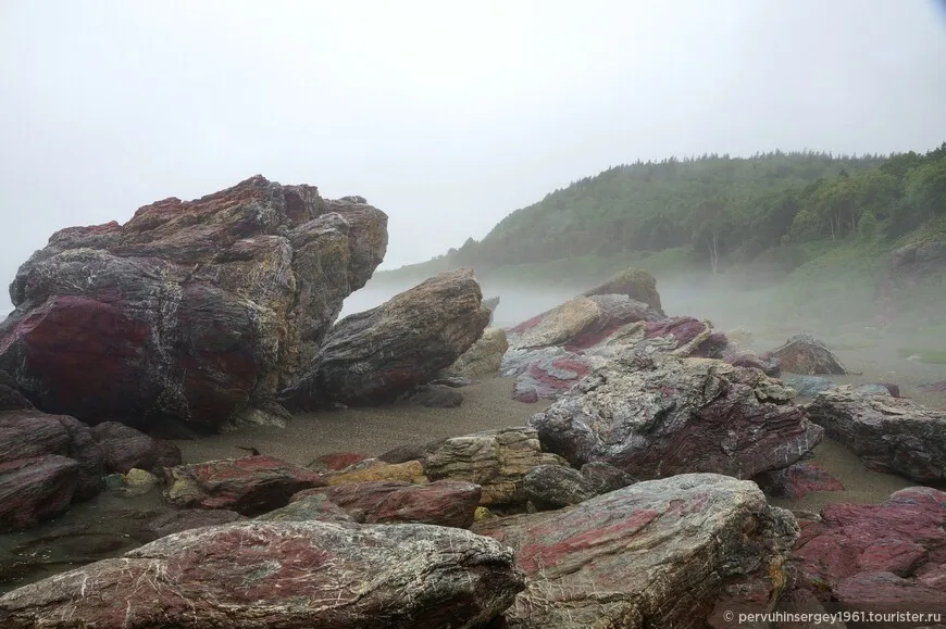
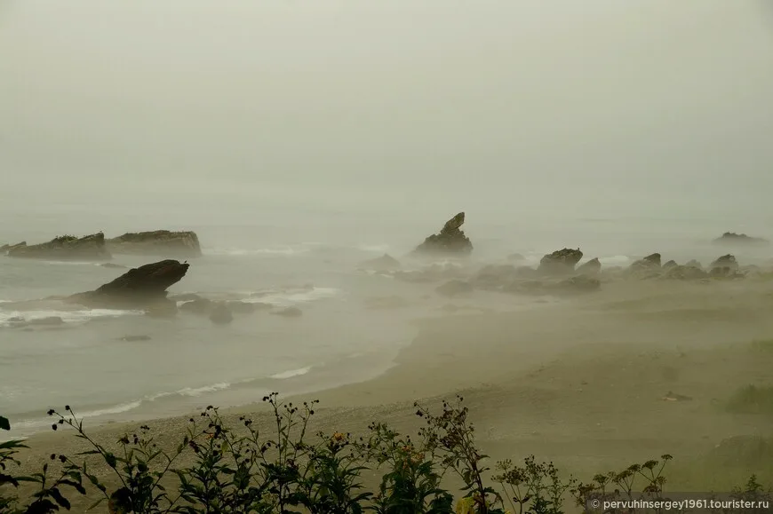
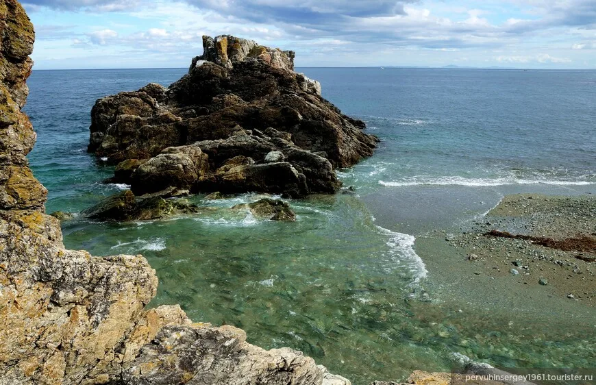
The cape's name — Sima, or Symau on some old maps — derives from the Ainu Simaukotan: "dwelling of stones". Stones are indeed everywhere here, in many colours, shapes and origins; they have stood on this shore since the beginning, long before the first humans, having tamed fire, came to settle the country. The cold water of the Sea of Okhotsk meets warm air from the inland valley at this cape, and on most mornings the whole shoreline wraps itself in dense fog from which the strange silhouettes of boulders emerge.
What you read in the rocks
Walking the shore, the eye assembles figures on its own: a bear and a turtle, a mammoth and a hare, a troll and a giant. No surprise that the place inspired respect among the indigenous inhabitants — and modern visitors who have walked it say there is no other shoreline like it. When the fog lifts, the stone "tenants" turn back into ordinary basalt blocks, but the first encounter stays with you.
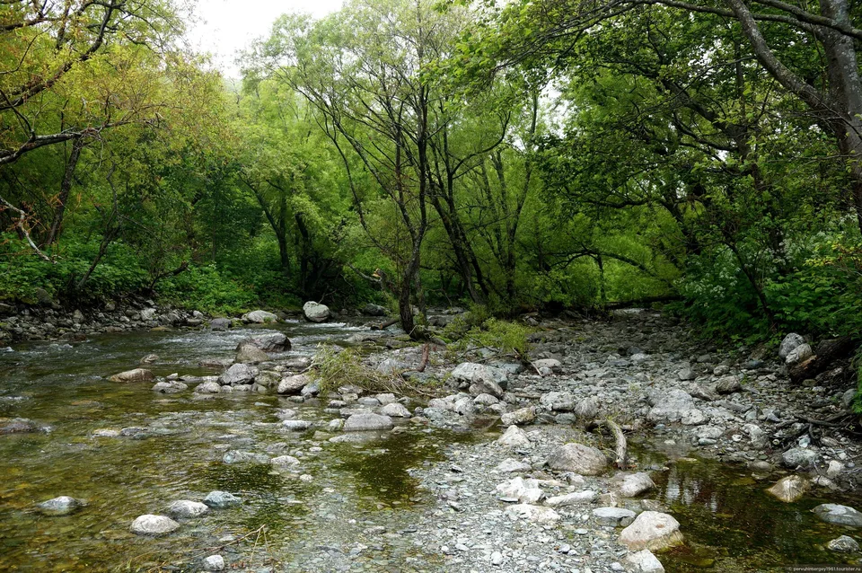
A mountain river of the same name — Sima (Symau) — runs through the cape into the sea. It runs between the rocks and carries no silt: the water around the cape is clear, and you can see both the beautiful stones on the riverbed and the marine life that has settled in the rock pools. The place is well known to Sakhalin anglers.
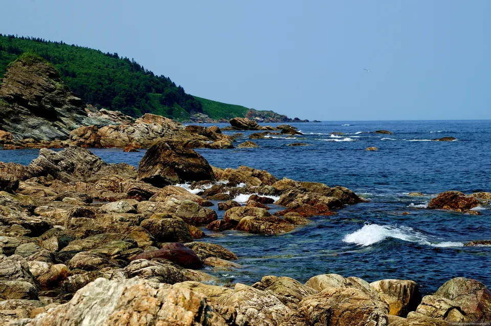
Geology and shoreline
The cape juts into the Sea of Okhotsk roughly 90 km north of Yuzhno-Sakhalinsk, in the Dolinsk District. The shoreline here is built from dark volcanic rock — low cliffs, sea-polished boulders and wave-cut platforms that extend well below the tideline — with a narrow pebble beach appearing only in the sheltered inlets between headland spurs. The terrain is modest in height; the cape rises perhaps 15–20 metres above mean sea level, but its exposure to the open ocean means the sea state is rarely gentle. Swell rolls in from thousands of kilometres of open water to the east and north-east, and spray carries metres inland in an easterly wind. The toponym "Symau" does not appear in early Russian colonial cartography — pointing to its Ainu rather than Russian-colonial origin; the Ainu inhabited eastern Sakhalin continuously into the mid-twentieth century, and many of the island's coastal names along the Okhotsk shore retain Ainu phonology.
The lighthouse
A working navigational lighthouse stands at the tip of Cape Symau, maintained by the Federal Agency for Sea and Inland Water Transport. The structure is a modest painted tower of Soviet-era construction, white with horizontal bands, rising approximately 12 metres. It marks the northern approach to Dolinsk Bay for coastal shipping and fishing vessels working the Okhotsk Sea grounds. The lighthouse is not open to visitors, but the access road that services it provides the most reliable route to the cape's headland viewpoint.
The lighthouse-and-rock combination reads especially well in overcast and storm light — the most common weather here. In the rare clear day the horizon stretches as far as the Kuril ridge; in a storm the cape becomes a stage where only foam and gull-cries are at work.
The Bear Waterfall, upstream
A few kilometres upstream of the river Sima stands the Bear Waterfall — beautiful, and dangerous. The pool below the falls is a favourite fishing spot for brown bears, who come here regularly; though the bear avoids meeting humans, "the master of the Sakhalin taiga" can often be seen here. A walk to the waterfall is a separate programme with its own safety briefing and the guide's deterrent spray.
Wildlife
In summer the basalt ledges hold breeding colonies of slaty-backed and black-tailed gulls; pelagic birds — tufted puffins, parakeet auklets, ancient murrelets — can be seen close to shore from June into September. Harbour seals haul out on the lower reefs. The water close to the cape is productive ground; local fishermen log Pacific white-sided dolphins and harbour porpoises with regularity. The coastal scrub and mixed forest behind the cape act as a stopover for migrating passerines in May and September.
The approach
From the town of Dolinsk (on the Yuzhno-Sakhalinsk–Nogliki highway), a short stretch of paved-and-dirt road, 20–30 minutes from the centre to the lighthouse access turn-off; the final section needs ground clearance after rain. AMIST programmes Symau into a single-day east-coast route — usually with cultural points of the Dolinsk District and the coast section north toward Starodubskoye.
Practical information
- Season: May–September for active birdlife and reliable road conditions; October–November for dramatic autumn light and good storm-watching weather.
- Bring: Waterproof boots, windproof shell, binoculars (for birds and seals). Wide-angle for the rock coastline; a 300 mm tele for the cliff-face nesting colonies.
- Access: The lighthouse access road is service-only, not a public path. AMIST groups have arranged access; independent visitors should stay outside the fence line and respect the lighthouse perimeter.
- Time: 1.5–2 hours from car park to headland tip at a comfortable pace; the Bear Waterfall is a separate half-day.
For landscape as it is
Cape Sima slips off the map easily — if you don't know it. AMIST's east-coast route stitches several low-visibility points between Yuzhno-Sakhalinsk and Dolinsk — this cape, a coastal cliff section, a fishing settlement — into one day, to show the modest but real beauty of Sakhalin's Okhotsk shore. Local guides, vehicles matched to the road, small groups. For travellers who come to the island for landscape as it is, not for the postcard.
Gallery

1 / 6
On the map
Want to see Cape Sima (Symau)?
We will arrange an excursion to this and other attractions